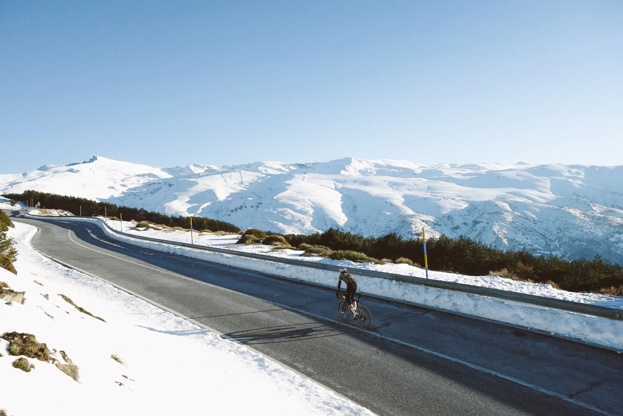
Cycling on the A-4025 with the Pico Veleta in the background
Climbing the Pico Veleta: Complete Cycling Guide
At 3,398 (11,148 ft) metres above sea level the Pico Veleta is Europe's highest paved road and consequently Europe's highest cycling climb. The meaning of the name literally translates as Pico or peak and Veleta meaning "weather vane", the name will perhaps take on a greater resonance as you approach the top.
Overview of the Pico Veleta Climb
key statistics of the CLIMB
Climb Category - HC
Length of climb - 42.2km
Summit elevation - 3,398M
Start elevation - 838M
Elevation gain - 2,700M
Gradient (avg) - 6%
The climb starts just outside of the city of Granada at 750m and arrives at the summit of 3398m some 43km later. A description of the Pico Veleta by author Daniel Friebe sums up the climb quite well, the Pico Veleta.."is taller and tougher than anything on the Tour de France but lacks in kudos what it offers in elevation precisely because of its height... it is, more simply put, too high. Too high for year-round access and too high, perhaps most to the point, to join the upper crust of professional cycling's most noble mountains".
This is precisely why the climb has never actually featured in the Vuelta Espana, it's simply too long, too high and too tough for a Grand Tour. The climb to the Sierra Nevada Ski Station has often featured in the Vuelta, it has never in modern times gone beyond the barrier at Hoya de la Mora at some 2,500 metres above sea level.


the Routes of pico veleta
They say there’s more into heaven and there’s more than one way to the top of the Pico Veleta, but it’s getting there that’s the challenge. A point worth remembering, for each approach outlined, is that the final 13kms from Hoya de la Mora, from this point on the road is closed to traffic. The final 8km are at an average of 8% and the last 4km the road deteriorates quite significantly.
1. Pinos genil - 41km - 2635m
Pinos Genil is just off the main road from Granada to the Ski Station, it’s a good place to start as there’s places to park or if cycling then it’s a more interesting road then the main road and you go straight into the climb. After the 13.7km there is a Repsol Garage on the left, we tend to stop here to quickly refill the water bottles. From here it’s just another 500m until you turn off the main road at El Dornajo on to the A-4025 and it’s another 13km to the barrier at Hoya de la Mora. From the barrier it’s another 8km to the top, so if you’re running low it’s advisable to top up at one of the kiosks at Hoya del Mora.
2. Monachil - 37.5km - 2723m
Monachil is a village a little further south west of Granada City. From here you start straight into the climb dubbed El Purche, it’s 8.3km and 670m in elevation gain with average gradient of 7.7% and pitches of 13% on the steeper sections. As a point of reference, Sepp Kuss covered this section in 23:51, if you fancy it! From El Purche there’s a brief descent of 1km until you come to the main road, at the 14km marker you pass the Repsol Garage on the left and shortly after turn left at El Dornajo and on to the A-4025 from here it’s just another 13km to Hoya de la Mora or 24km to the Pico.
3. Güéjar Sierra - 43.2km - 2836m
This is probably the toughest route to take on the Pico, once you pass through the village of Güejar Sierra you start on to the climb of Alto de Hazallanas 7.3km with an elevation gain of 704m and and average gradient of 9.5%. You can check out the Strava leaderboard here. From the Hazallanas it’s 12km to barrier or 23km to the top.
4. alternate Güéjar Sierra - 46km - 2777m
A slight variation of the #3 is to continue further into the valley at Güejar Sierra to exclude the Alto de Hazallanas climb. This is one of favourite approaches as it’s very quiet road with beautiful scenery and it’s not as as steep as Hazallanas but you end up at the same place.


best time to Ride it Pico veleta
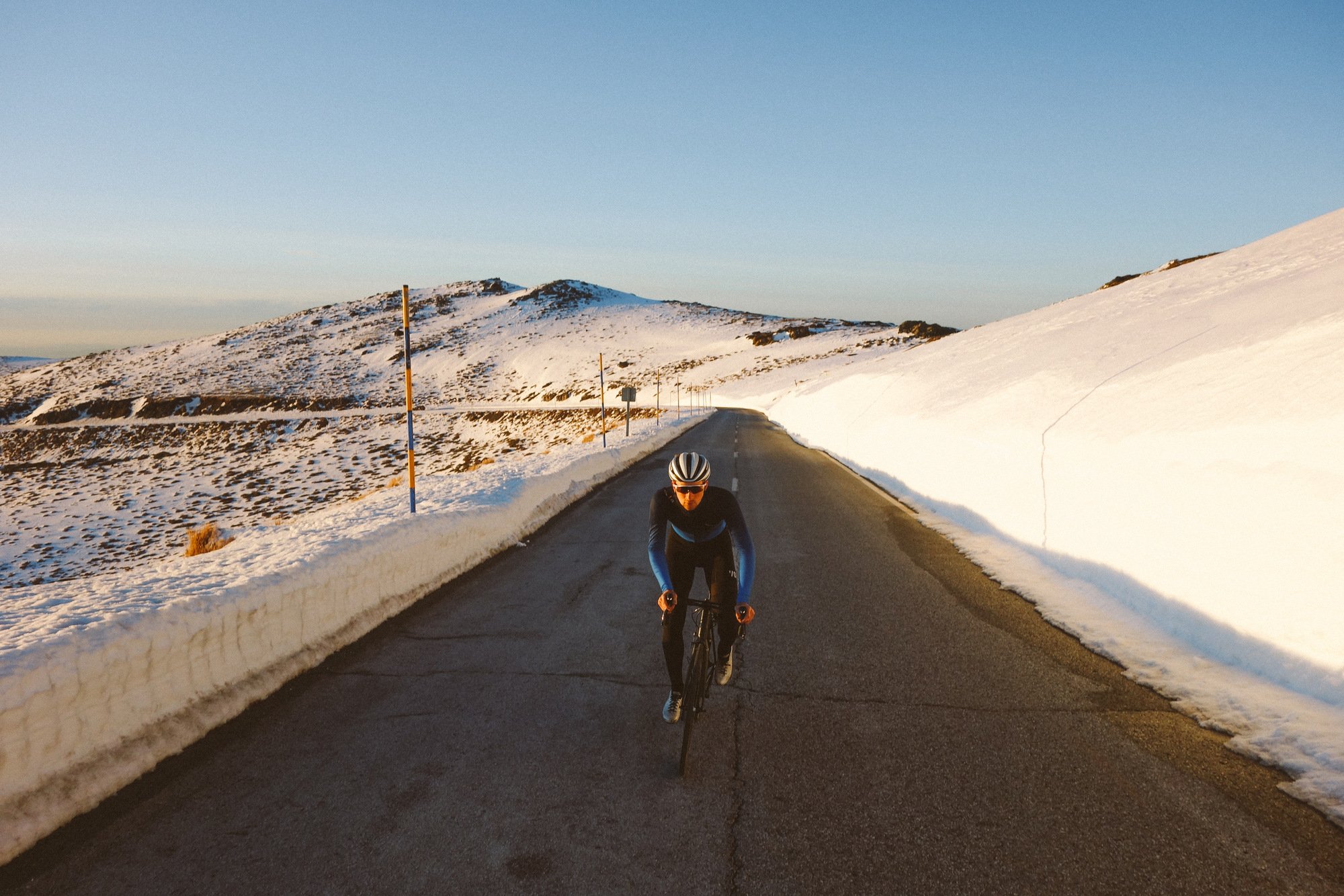
The Pico is generally possible to ride from the end of May until the last week of October. These dates aren't set in stone and it really depends on when the first snow fall occurs to when the snow clears in the spring. As a point of reference the photos displayed here were taken in early March - it was not possible to go beyond the barrier. Based on the on the past few years it's generally a safe bet from May to the end of October.
During the summer months it’s best to start very early to avoid the heat - the city of Granada can frequently reach temperatures above 40c in July and August. September and October are generally the most favourable months to ride the Pico de Veleta as the heat has generally subsided, there is less traffic up to the ski station and the top is mostly free from snow.
Preparation and Tips
Essential Gear
Weather Considerations
Training Tips

Veni, vidi, vici
I came, I saw, I conquered... well why not get the Pico Veleta jersey to prove it?! (click here)
rIDE THE VELETA WITH US
From September onwards we offer catered packages and the highlight is taking on the Pico Veleta. Why not join us and let us look after all of the logistics, so you can concentrate on just riding your bike? (Learn more)
